Get to know the history of the whole Bratislava region, the most beautiful tajchs around Banská Štiavnica, as well as UNESCO monuments in the Spiš region, the Tokaj wine region or the mysterious Poloniny – all on two wheels and with the wind in your hair. We invite you to discover Slovakia from the seat of a bicycle.
The pace and difficulty of the routes will be up to you. Experiences and memories are not measured by speed and elevation changes, but by delightful moments in good company on the road and a feeling of happiness and satisfaction at the finish line. If beautiful Slovak nature, enchanting views, historical attractions or adrenaline-pumping downhill runs are a bonus, then a cycling trip is the clear choice.
The weather will be favourable for bicycle lovers for several more weeks. Families with children, recreational riders and sporting professionals, too – they all really have a lot to choose from. Slovakia is crisscrossed with cycling routes and cycling paths. We offer more than 50 official cycling routes and over 14,000 kilometres of marked cycling paths.
If we have sufficiently motivated you and you are now thinking about where you would go on your first or next cycling trip, we’ve prepared an overview of several interesting routes that will definitely not disappoint. Read the tips directly from the regions and set off on your bike across Slovakia.
The Bratislava Region will please cyclists with its historical treasures
In the Bratislava region, we certainly recommend you set off on a cycling trip along the EuroVelo 13 route, also known as the Iron Curtain Trail. By taking it, you’ll come to know the cultural and natural points of interest along both banks of the Morava River on the Slovakia-Austria border. The Iron Curtain, which stretched from the Barents Sea to the Bosphorus, divided Europe for about 40 years. A so-called Green Belt was created along this strictly guarded border zone, an area of valuable habitats that has been preserved.
Thanks to open border crossings and the ferry between Slovakia and Austria, you can easily cross from one side to the other. The Green Belt on the Austrian side is followed by the KTM (Kamp – Thaya – March) cycling route, and in Slovakia it leads directly along the former border guard signal fence as the above-mentioned EuroVelo 13 route. You’ll not only come across fascinating, untouched natural scenery, but also many cultural and historical landmarks.
You should certainly see the “Trojhraničie”, or “Tripoint”. At the confluence of the two largest Moravian rivers – the Morava and the Thaya (called the Dyje in Czechia) – lies the southernmost point of Morava as well as the place where the borders of Slovakia, Czechia and Austria meet. One of Europe’s largest floodplain forests is located here. The area is characterised by a dense network of meandering river branches and periodically flooded pools. In the vicinity you’ll also find the historic boundary stone, which was installed in 1755 by Empress Maria Theresa.


The Chapel of St. Roch is definitely worth visiting. You’ll first see it from afar because it is located on Rochusberg Hill. The chapel provides a magnificent view of the Weinviertel region, located in the floodplain of the Morava River and the Little Carpathians. This is a unique architectural structure, a rare example from the Italian Renaissance. The famous Freedom Cycling Bridge over the Morava River links the Bratislava district of Devínska Nová Ves with the Austrian castle Schloss Hof. It is symbolically located in the same place as the historic bridge from the time of Maria Theresa. The remnants of that bridge’s pillars are still preserved.
In the nearby village of Veľké Leváre you’ll find a rich harvest of edible mushrooms and deep pine forests, but it is particularly famous for the Hutterite Yard. A complex of 22 folk buildings from the 17th to 19th centuries creates the largest preserved site of the original Hutterite dwellings in Europe. The Hutterites were very skilled craftsmen who founded independent communities in our territory with distinctive architecture and left behind truly remarkable buildings. We highly recommend a visit to the Izer’s House, which is home to the Hutterite Crafts Museum. The Hutterites were also known for their production of pottery.
Lovers of history should definitely stop at the world-famous Sandberg palaeontological site. The remains of more than 250 species of marine and terrestrial animals from the times when the prehistoric Tethys Sea covered this area have been found here. Also of interest are the bunkers that were built here as part of the defensive fortifications of Czechoslovakia after Adolf Hitler rose to power. They were later used by the German army on the basis of the Munich Agreement.
There were originally 5,832 such bunkers in Czechoslovakia. Among the best-preserved today are the B-S-1 “Štěrkoviště” (in Jelení háj opposite the mouth of the Karlovy Vary river branch), the B-S-4 “Lány” (near the cycling path at the Berg border crossing) and the B-S-8 “Hřbitov” (not far from Kopčianska ulica, near the cemetery of soldiers from the First World War). Of interest is the fact that Eva Braun and Adolf Hitler supposedly visited the B-S-8 “Hřbitov” bunker.
The EuroVelo 6 cycling route in the Nitra Region is full of experiences
Do you love cycling, nature, history, wine and water? Then the Podunajsko area of the Nitra Region is perfect for you. Get ready for the approximately 80-kilometre ride along the EuroVelo 6 route, which will take you through places you will never forget. The route is suitable for all types of bicycles and all ages.
Your adventure begins at the Číčov dead river branch, home to rare species of birds and plants, including the endangered Tundra vole. Beautiful sections along the dam will lead you through the Danube floodplain forests to Veľké Kosihy, where you can enjoy 360-degree views from the observation tower. Just a bit further on you’ll find Veľký Lél island with the Ekofarma Ostrov (Ecofarm Ostrov), where the Zlatý Hucul campsite is located, an ideal place for caravanners. Along with accommodation, you can enjoy bird watching, horseback riding or water tourism here.
You’ll then continue to Komárno, where you will be charmed by the famous Courtyard of Europe with its unique architecture. Just a short distance from the town centre stands the Komárňanská pevnosť Fortress – a jewel of Central Europe and part of the largest fortress system. Did you know that this fortress has survived earthquakes and the Napoleonic Wars? Just over the bridge crossing the Váh River you’ll discover an important UNESCO monument – the former Roman fort in Iža.

Photo: krizomkrajom.sk

Photo: krizomkrajom.sk
A few kilometres further along the embankment will take you to the southernmost point of Slovakia near the village of Patince, where you will find a spa, a wellness hotel, a dock and lovely poppy fields. In the village of Žitava, don’t forget the Monument to the Žitava Peace, commemorating an important peace treaty from 1606. In Radvaň nad Dunajom, you can treat yourself to a tasty snack at the Mlyn guesthouse, which offers a magnificent view of the Danube.
From here, the village of Kravany nad Dunajom will gradually appear in the distance. At the visitor centre you can arrange a cruise along the Danube on the small rowboats. Lovers of history will love the two former manor houses located here, one that belonged to the Láng family and the other to the Szarvassy family. Not far from the village you’ll find the magical Bottka Farm, where you can camp amidst the natural surroundings.
Further along, the road leads you past the historic Slavic fortress of Mužla-Čenkov, and you’ll slowly arrive at your destination – the town of Štúrovo. Here you can find a fun thermal park, the historic Mária Valérie bridge, as well as beautiful views of the Danube.
You’ll find more information about the EuroVelo 6 cycle route here: krizomkrajom.sk
The Horná Nitra (Upper Nitra) region surprises with its peaceful cycling trips and challenging trails

Photo: OOCR RHNB archives
The Upper Nitra region offers several interesting cycling paths. One of them is the Hornonitrianska (Ponitrianska) cyklomagistrála (Upper Nitra Cycling Route) running a total length of 66 kilometres. The route, which is marked by red cycling route signs, begins at the source of the Nitra River below Kľak Hill and leads through Bojnice, Nováky and Partizánske to the village of Žabokreky nad Nitrou. It runs along paved roads; thus, it is a road cycling route whose profile is relatively undemanding.
The route goes past by many locations that are definitely worth a visit, whether you decide on a hike to the top of Kľak Hill, or a visit to the Vyšehrad National Nature Reserve or the Kanianka reservoir. A guaranteed winning tip is Bojnice, a place where you can spend several days. Here you’ll find a fairy-tale castle, the oldest zoo in Slovakia as well as an observation tower and a spa.
A cycling trip can be enlivened for both young and old by a visit to the Banský náučný chodník (Mining Instructional Trail) in Nováky or the ruins of the Sivý Kameň hrad Castle. You can also refresh yourself at the thermal swimming pool at Chalmová, visit the Manor House in Čereňany or the Vodný hrad water castle in Šimonovany.
You’ll find more information at: tn.cykloportal.sk
The Bojnický cyklookruh (Bojnice cycling circuit) measures an impressive 162 kilometres in length. The route is marked in blue, and you can complete it in two days. It starts in Nitrianske Pravno, from where it continues through Tužina towards the village of Temeš. It then leads through Diviaky nad Nitricou, Dolné Vestenice, Skačany and Oslany to the Bystričianska dolina valley and under the Vtáčnik pohorie Highlands to the village of Cigeľ and the town of Handlová. From Handlová, the route runs through Remata and Ráztočno and then back to Nitrianske Pravno.
The route is intended for more demanding cyclists, as it includes climbs to mountain saddles and riding on both paved and unpaved forest roads. Surprisingly, despite its name, it does not pass through the town of Bojnice itself.
The cycling route is filled with attractions that will delight all visitors and history enthusiasts. In Handlová, you can visit the Slovenské Banské múzeum (Slovak Mining Museum) or hike the instructional mining trail. We also recommend a hike to Malý and Veľký Gríč or a visit to Nitrianske Pravno and Nitrianske Rudno.

Photo: OOCR RHNB archives

Photo: OOCR RHNB archives
The village of Čavoj will delight you with Hogwarts in the Clouds, an experience accommodation site inspired by the books about the wizard Harry Potter. Partizánske will surprise you with its Gothic-Renaissance manor house, its museum or an information and tourist centre called Baťa point.
You’ll find more information at: tn.cykloportal.sk
The Rokošská radiála (Rokoš radial) route is almost 26 kilometres long. It is marked in green and starts at the sports hall in Prievidza, from where it heads to Bojnice and past the hospital in the direction of Kanianka. Before the village, however, the path turns off into the hills, towards the Bohátka chata Cottage to Šútovské sedlo Saddle.
From the saddle, it then sharply descends into the village of Šútovce, from where it continues through the villages of Dlžín and Kostolná Ves to the Nitrianske Rudno dam. From the reservoir, the route then passes through Rudnianska Lehota and continues to the Sedlo pod Čiernym vrchom Saddle, where it ends. The radial is a rather demanding route, with almost 1,000 metres of vertical ascent. It runs along an asphalt path, but mostly on unpaved forest roads.
You’ll find more information at: tn.cykloportal.sk
In this region, you should definitely try out the Cycling Trails in Bojnice (visitbojnice.sk) or the Velosvet Turzov skill park in Bojnice. It is intended for riders of all ages and performance categories. It offers two easy flow trails, the medium-difficult North Shore line trail, two difficult trails (the Boner line and Dirt line), and finally the very difficult Pro Dirt line.
You’ll find more information at: visitbojnice.sk
Around Banská Štiavnica, you’ll be enchanted by an impressive ride to three tajchs (artificial ponds)
The Horný Hodrušský tajch near the Salamandra resort, and the Veľká Richňava and Kopanický tajchs – a smooth ride along them with plenty of views, multiple opportunities for good refreshments and a ride along the Helligon flow trail. This cycling trip contains the best that the Štiavnické vrchy Mountains has to offer to mountain bikers. The circuit leads through several entry points – Červená studňa, Horná Roveň, the Veľká Richňava tajch, Kopanice and the Salamandra resort. You can start riding the route at any of them.
It includes one steep five-kilometre stretch climbing from the Salamandra resort to the highest point above Červená studňa and several shorter, steeper climbs. This “effort” is balanced out by a leisurely, almost five-kilometre ride along the flat but winding body of the Horný Hodrušský gulley. From the gulley, you’ll descend to the Salamandra resort along the Helligon flow trail. The ride is not intended for beginners due to its banked turns, undulating terrain and steeper gradient at the beginning.
You’ll find more cycling routes in the region here: bajkomktajchom.sk

Terka_109806542_3159567467470416_7486796795348447295_n.jpg "Cycling to tajchs near Banská Štiavnica")
From castle walls to the scents of the countryside – cycling trips in the Novohrad and Podpoľanie regions
Cycling tours from Modrý Kameň to Dolná Strehová are easy, approximately 30 kilometres long. The climb of about 333 vertical metres and the descent of 398 vertical metres make them an ideal choice for recreational cyclists who want to combine nature, culture and history on two wheels.
The route starts from the smallest town in Slovakia, Modrý Kameň. Immediately at the start, you’ll feel enchanted by the romantic ruin of Modrý Kameň Castle. The baroque manor house in the area before the castle also houses the famous Múzeum bábkarských kultúr a hračiek (Museum of Puppet Cultures and Toys). The entire building breathes history and offers unique views of the surroundings.
The route glides smoothly from the castle along Zámocká ulica towards Dolné Strháre where a fascinating “Kostolisko“ (church site) is hidden. It contains the archaeological remains of as many as four medieval churches. The route run further through flat sections through Pôtor to Dolná Strehová, where the local swimming pool is a great place to relax.
You can get to know the local culture through the Múzeum Imre Madácha (Imre Madách Museum), situated in a beautifully reconstructed manor house with an English park. The next stop is the settlement of Prieloh. Here you can visit the Lavella farm which has domestic animals and also offers fresh dairy products.
Are you looking for a cycling path that combines natural beauty, historical monuments and geological attractions? We recommend the Južná turistická magistrála (Southern Tourist Route). It stretches more than 21 kilometres in length and leads through the western part of the Cerová vrchovina Highlands, predominately along the state border between Slovakia and Hungary. It thus offers a unique opportunity to get to know the beauties of southern Slovakia. The total riding time is around six hours; the route is of medium difficulty with an elevation gain of approximately 531 metres.


It begins in the village of Lipovany, which is an ideal starting point for the route. From the church in the centre, you can reach the observation tower above the Lipovany sandstones. This natural formation is among the most interesting geological phenomena of the surrounding area and is a great place for a first stop.
On the way further you will come across the Mučínska jaskyňa Cave, which is a unique natural treasure located near the Slovakia – Hungary state border. The cave contains fascinating geological formations and is a popular destination for hikers and cyclists both.
Above the Lipovany sandstones is also an observation tower more than twenty metres high, from which beautiful panoramic views of the surrounding landscape open. This is thus an ideal place for a short break, relaxation and refreshment.
The route continues through the Novohradský geopark, which is rich in natural and historical monuments. During the ride, you can admire a variety of rare flora and fauna, as well as historical buildings that complete the unique atmosphere of this region. The destination of the ride is Šomoška hrad Castle, which is one of the most beautiful ruins in Slovakia.
Families with children, recreational cyclists and professionals come to enjoy the Liptov region

Photo: OOCR Región Liptov / visitliptov.sk
The Liptov invites all fans of cycling to discover the thematic cycling route called Po stopách zaplavených obcí Liptovskej Mary (In the Footsteps of the Flooded Villages of Liptovská Mara). Aside from sporting activities and beautiful views, it offers interesting information about the reservoir here, which fundamentally affected the lives of thousands of people and forever changed the face and development of the entire region.
The circular route starts at the Infopoint in the centre of the village of Bešeňová. From there, you’ll head to the dam of the Bešeňová Reservoir, then through the village of Vlachy to the dam wall. After that, cyclists will come to the church tower at Liptovská Mara and continue through the settlement of Tvarožná to the iconic viewpoint and photo point Kyseľovec.
The journey ends in the village of Bobrovník near Marina Liptov, with a subsequent return along the dam wall to the historic building of the original railway stop in the settlement of Vlašky and back to Bešeňová. The route has several steep climbs, which is why we recommend it to be undertaken by more experienced cyclists or with the use of electric bicycles.
An interesting way to enliven the day can be a visit to the Miniskanzen zatopených obcí (Museum of Flooded Villages) in the area of Koliba Gréta on the banks of Liptovská Mara in Liptovská Sielnica. You’ll also learn valuable information about other extinct villages from the central and eastern part of the reservoir, which this thematic cycle route does not pass by.
Some 50 years have passed since the completion of the Liptovská Mara reservoir, and people in the Liptov no longer fear devastating floods and the region has become a popular tourist destination. Thanks to the already mentioned cycling route, you can enjoy beautiful views over the water and mountains from the saddle of a bicycle and learn interesting facts and facts about the history of the waterworks and the circumstances associated with them.
You can also set off to explore the important historical and cultural monuments of the Liptov by bicycle. Did you know that the Cyklotrasa Vlkolínec – Pribylina (Vlkolínec – Pribylina Cycling Route) is the longest instructional cycling route in Slovakia? It begins in the UNESCO village of Vlkolínec and continues through Ružomberok, Liptovská Štiavnica and Partizánska Ľupča, where it then connects to the Liptovská and Vrchárska cycling route.
Beyond the village of Lazisko, a turnoff takes you to the wooden articular church in Svätý Kríž, the largest such church in Central Europe. The route then climbs to the lookout tower in Pavčina Lehota with views of the Nízke Tatry mountains and then descends to the Demänovská dolina valley. It passes the Bystrina car camping site and the villages of Ploštín, Iľanovo and Závažná Poruba. Near Liptovský Ján, it passes by a natural swimming pool suitable for refreshing yourself.
A shorter section leads along a busy road to Liptovský Hrádok, where the route splits from the Liptov cycling route and continues along the Belá River embankment. A possible turnoff leads to the Liptovský Hrádok castle and manor house. Near the end the route is a section through Liptovský Peter and the observation tower near Vavrišov, which offers views of the Tatra Mountains. The route finishes in Pribylina at the entrance to the Museum of the Liptov Village.
You can find more cycling routes in the Liptov here: visitliptov.sk

Photo: OOCR Región Liptov / visitliptov.sk

Photo: OOCR Región Liptov / visitliptov.sk
Discover the Turiec region from the saddle of a bicycle

Photo: OOCR archive
The Turiec region was made for cyclists. It stretches between the Veľká and Malá Fatra mountain ranges, offering dozens of cycling paths that combine the beauty of nature, the calm of the countryside and a touch of history. Whether you are a recreational rider, an athletic cyclist or a family with children, the Turiec will surprise you with the diversity of its offer.
You can choose from more than 11 routes with varying levels of difficulty – from leisurely trips through villages and valleys to challenges with climbs to elevations of over 1,400 m above sea level. The routes will lead you through places where nature meets culture – past the Sklabiňa castle, Martinské Hole, Gaderská dolina valley, manor houses or chalets, which offer tastings of local specialties.
The northern routes start from Martin and wind their way under the Veľká Fatra mountains. The basic 60-kilometre route leads you through Sklabiňa, Turčianska Štiavnička and Sučany to Vrútky. More sporting extensions include hikes up to the peaks Chleb or Kľačianska Magura. If you’re looking for panoramic views, head for Martinské hole – from there, with good visibility, you can see as far as the High Tatras mountains.
The southern routes start in Turčianske Teplice. The route through Blatnica and Gaderská dolina valley will captivate you with the rocks and forest trails that take you to the ruins of Blatnický castle. Or the route through Kláštor pod Znievom and the Polerieka valley is an ideal combination of cycling and relaxation.
The middle route links Martin with Kláštor pod Znievom, Blatnica and Necpaly. The basic version is approximately 60 kilometres long, and an extension also leads to the Jasenská dolina valley and to the viewing meadows above Turčianske Jaseno.
Are you looking for a genuine cycling challenge? Our tip is the Turčianska magistrála and the Znievska cesta (Turiec route and the Znievska path), which stretches approximately 100 kilometres in length. It runs over asphalt and is intended for experienced riders. It begins in Vrútky and leads you across the entire region. Aside from cycling performance, you’ll also take away a visual experience – views over the basin, castles, manor houses and scenery that are worth every turn of the pedals.
You can find all the routes at: https://turiec.com/balicky/e-bike-program-v-turci/

Photo: OOCR archive

Photo: Mr. Hajkovský
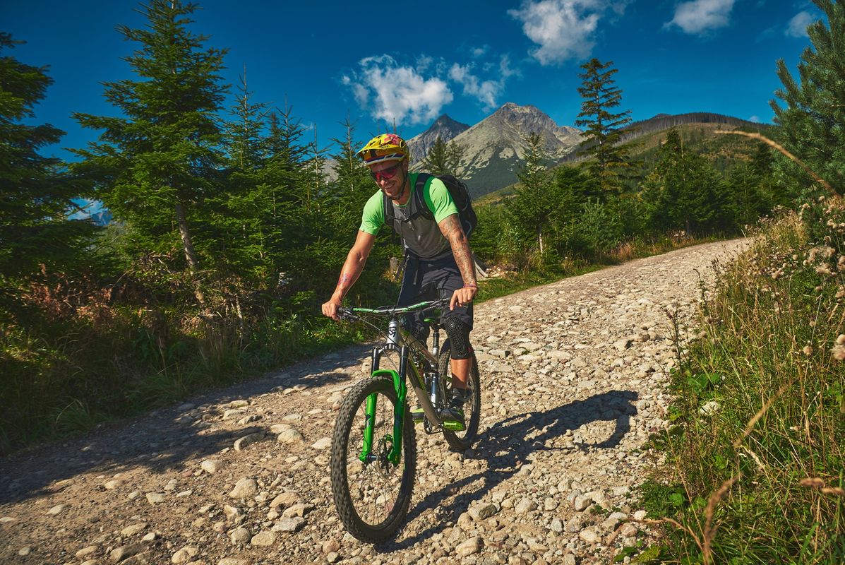
Introducing cycling challenges in the Vysoké Tatry Mountains
")
You’ll experience unforgettable adventures by cycling in the Vysoké Tatry Mountains. The Tatranská vrchárska koruna (Tatra Mountain Crown) is one of the legendary cycling routes in Slovakia. At roughly 90 kilometres in length and with an elevation gain of around 2,300 metres, it links four Tatra climbs – Popradské pleso, Sliezsky dom mountain chalet, Hrebienok and Štart – that will test the fitness and experience of any cyclist.
Each climb has its own atmosphere – from the moderate (and frequented by tourists) ride to Popradské pleso, through the demanding and steep climb to Sliezsky dom mountain chalet, to the shorter, but intense climbs to Hrebienok and Štart. The route is intended for road bikes and experienced riders who are looking to combine a physical challenge, beautiful views and the Tatra atmosphere.
Another cycling trip will lead you to the extinct medieval settlement of Šoldov. The route is 18 kilometres long and runs from the Štrbské Pleso railway station through Tatranská Štrba and Tatranský Lieskovec to Šoldov and back. The remains of the extinct medieval settlement of Šoldov are located on the edge of the village of Štrba in the foothills of the Tatra mountains. The settlement is shrouded in mystery, as there are almost no mentions of it in historical sources. The assumption is that it was older than all the surrounding villages under the Tatras. Aside from houses, the settlement also had a church, possibly even a Benedictine monastery.
Šoldov is an important historical site. For example, skeletons of people over 200 centimetres tall have been found here. This is perhaps why the rumour spread in the nearby surroundings that giants lived in the area. In addition to the partially reconstructed buildings of the settlement, there is also a monument, an information board and a small seating area.
You can also explore the Vysoké Tatry mountains on the Poprad centre – Kvetnica route, which leads along the Poprad cycling route before continuing towards the Poprad shooting range and Kvetnica circuit. You’ll cover a total of 14 kilometres along the way. The city part of Poprad and the Kvetnica recreational area are both in the Kozie chrbty mountain range.
The Kvetnica instructional trail leads through the area and offers six stops that present the forest vegetation stages of Slovakia in a small area of the Poprad city forests, the historical archaeological site of Zámčisko and the National Nature Reserve of Hranovnícka Dubina. Hiking trails and a hunting lodge where mouflon and wild boar are bred are also available here.
Two quarries with the occurrence of minerals are also located in this area. One is flooded and is used for recreational purposes. The site also includes mining shafts – the St. Helena gallery and the Strieborná gallery.
You’ll find more tips for cycling trips in the Vysoké Tatry mountains region at: https://regiontatry.sk/cyklistika/


The northern Spiš and Pieniny regions will amaze you with trails of varying degrees of difficulty
In the northern Spiš and Pieniny regions, we recommend a visit to the smaller single-trail resort Cyklostopy, which is located in the urban forests of Stará Ľubovňa. The trails are built under Oslí vrch peak and are named after animals. The Cyklostopy area is surrounded by the famous Ľubovňa hrad castle as well as an open-air museum and a military exhibition. At the start of the trails is a shelter – Cyklochyža – where you can also sleep on the upper floor.
Everything in the resort is marked clearly and in detail, so you can plan your rides well. All but one of the trails – the Jazvečia stopa (Badger Trail) – are one-way trails. There are eight trails in total, and they are designed for experienced cyclists who have mastered off-road riding skills. The Jelenia stopa (Deer Trail) starts on a flat surface and climbs moderately, with lovely curves starting at about the halfway mark.
Try to guess the name of the most difficult Cyklostopy trail? It’s the Líščia stopa (Fox Trail). Its character is rougher, with a lot of rocks and roots on the terrain. The easiest trail is the Srnčia stopa (Roe Deer Trail). The Vlčia stopa (Wolf Trail) is characterised by its banked turns and undulations, and on the Medvedia stopa (Bear Trail) is an excellent jumping trail, designed especially for experienced riders. The Rysia stopa (Lynx Trail) is short, but also steep and fun.


The Košice Region will take you on a cycling tour through the gems of the Spiš region
The Cyklotrasa Spiš and Spišský hrad Castle cycling route is a little over 17 kilometres long and of moderate difficulty, but it will still reward you with beautiful scenery and an overview of the most important monuments in the entire region.
It starts at the parking lot in Spišské Podhradie, the village below the castle, and continues towards the village centre. From there, you’ll head up a slight incline to the Spišská Kapitula chapter. Some places here have not yet been marked and are not always clearly visible; we therefore recommend having GPS coordinates downloaded. You’ll travel much more confidently and smoothly.
At Spišská Kapitula chapter, you’ll pass through the “gate” and then across the main road. The route then leads through extensive meadows with a view of Spišský hrad castle. The Chapel of St. Rosalie is a good landmark. You’ll go along the forest to the right of it to the Spišský salaš chalet and afterwards, you’ll come out onto the main road. From there, after a short descent, turn left to another chapel known as Sivá brada.
From it, you’ll descend along an inconspicuous path. A short trip across a meadow will take you back to the chapel of St. Rosalie. Have you had enough of taking in the beautiful views of the landscape and its monuments? If so, then descend back to Spišské Podhradie to the starting point.

Photo: Košice Region Tourism

Photo: Košice Region Tourism
This time, go uphill from the parking lot towards the castle. Then, just before the steep climb, turn right. You’ll go past a small quarry and after that, turn left. You’ll climb Ostrá hora Hill, from where there are additional beautiful views of Spišský hrad castle. Return a short distance from the top and continue along the forest to Skalné mesto.
After that, a short climb awaits you, through which you’ll have to carry the bicycles for a few metres to get to the plateau above the rocks. However, the descent that follows is well worth it. Views and paths through a tall grassy meadow await you until you come to a concrete road. Turn left onto it and then after a few metres right onto a dirt road into the village of Žehra.
Here you’ll definitely want to stop and see the Church of the Holy Spirit by the cemetery. Continue along the main road and the red cycling path to Hodkovce. After passing through the village, turn left to Spišský hrad castle. You guessed it – right now is the ideal time to visit the castle. You’ll then ride back to the parking lot in Spišské Podhradie along the path around the castle walls.
Spišský hrad castle is one of the largest castles in Central Europe. In 1993 it was inscribed on the UNESCO World Heritage List. It is a national cultural monument and a living museum. The area around the castle is ideal for walks along the Sivá Brada – Dreveník instructional trail, which presents the history and natural attractions of the region at eight stops.
Between Spišský hrad castle and Spišská Kapitula chapter lies the town of Spišské Podhradie. In the 14th century, it became an important centre of crafts and also has a rich architectural past. The most important monument is the Romanesque Church of the Nativity of the Virgin Mary with a Gothic altar, but the Renaissance and Baroque town houses, the Baroque church and the monastery of the Brothers of Mercy are also enchanting. In 1948, the church centre of the Spiš region, Spišská Kapitula chapter, was annexed to the town. Its dominant feature is the Gothic Cathedral of St. Martin, and the clock tower is also a monument.
The Tokaj Cycling Route – Set off on a bicycle ride for liquid gold
The Tokaj winegrowing region spreads out over the Bodrog River basin. To the north it is bordered by the Zemplínske vrchy Mountains and Rozhľadňa Peak, and to the south, now on Hungarian territory, the border is formed by the confluence of the Tisa and Bodrog rivers. Although the Slovak part of the region is small, it is among the five areas in the world where grapes are grown for making naturally sweet wines. A visit to Tokaj is not to be forgotten. Wandering through the old tuff cellars, where genuine Tokaj wines mature in wooden barrels, is a wonderful adventure.
Tokaj, however, offers other attractions besides wine. Getting to know the region from the saddle of a bicycle brings a new dimension and unique experiences as you can explore the wider surroundings on cycling routes. We’ll tell you that it is sprinkled with archaeological sites, national cultural monuments, protected areas and unique wine cellars. Cycling is becoming increasingly popular in this area as it allows you to travel and discover Tokaj at your own pace.
The Tokaj Cycling Route is almost 30 kilometres long and has an undemanding profile. It starts in the centre of the village of Malá Tŕňa. On the square there are signs, a map of the surrounding cycling routes, and bicycle repair tools with a pump. Follow the red cycling signs towards the observation tower. After taking in its views, continue to an inconspicuous intersection between vineyards. Here you’ll turn right onto the black-marked path. This is a pleasant shortcut past the vineyards to the village of Bara.
At the large intersection there, turn left onto the green and yellow signs, which run almost in parallel. You’ll pass through the entire village of Malá Bara and only before the village of Viničky, at a crossroads in the fields, stay with the yellow signs and continue straight. You’ll then come to a winery, which is definitely worth a stop. Then continue on the yellow-marked path and you’ll reach a bridge over the Bodrog River.
Before the bridge, there is a red-marked trail, which you’ll follow to the right along the dam. Pass through the village of Borša to the village of Malá Bara. This time, you’ll leave the red signs again and take the green one. A moderate climb awaits you under the hill, where there is a lookout tower, and you’ll then go all the way back to the beginning to the village of Malá Tŕňa, where the route ends.

Photo: Košice Region Tourism

Photo: Košice Region Tourism
The Šariš cycling circuit will take you through the entire region around Prešov
The Šarišský cyklookruh (Šariš cycling circuit) is the first marked cycling route in the Prešov area intended for mountain and cross-country bikes. It leads through the Šarišská vrchovina Uplands mainly along field and forest roads, not on state roads. It is circular, marked with a green sign, and is almost 25 kilometres long.
Along the way, you’ll come across several points of interest. For example, above Haniska, on the Furča hill at an elevation of 309.5 m above sea level, is the Monument to a Peasants’ Revolt, which broke out in 1831. Along the way, you’ll also come across the Kadlubek mineral spring, where there is a rest area and the Kvašná Voda mineral spring. In the vicinity of the route, a slight climb will take you to the Ortáše Arboretum.
More information can be found at: outdooractive.sk


A unique cycling route in eastern Slovakia – introducing the Poloniny Trail
The Poloniny Trail is a marked cycling route under construction that passes through the Poloniny National Park in eastern Slovakia. It is known for its untouched nature, extensive beech forests listed as a UNESCO World Heritage Site, and rich biodiversity. At present, you can ride the completed cycle route from the Starina water reservoir to the former village of Ruské, called Zubor, which has a total length of more than 14 kilometres.
More gifted cyclists will appreciate the opportunity to ride all the way to the Slovakia – Poland border to Ruské sedlo saddle on the Salamandra route. This northernmost tip of the Poloniny Trail connects to the historic Porta Rusica route. Did you know that this once served as a trade route and is considered the oldest trade route built in Upper Hungary? It connected Michalovce with Baligrod, leading through Ruské, Ruské sedlo, Roztoky and continued to Galicia.
The best-preserved section also reveals the achievements of the technical thinking at the time – culverts, bridges, barriers, kilometre markers. The Poloniny Trail route then continues towards the villages of Runina, Ruský Potok, Uličské Krivé and Ulič, from where it leads via a connection to the village of Ruská Volová. This is already connected by a second-class road to the village of Ubľa and the border crossing to Ukraine.

Photo: PSK – Prešov Self-Governing Region

Photo: PSK – Prešov Self-Governing Region
At the beginning of summer 2025, 11.5 kilometres of new cycling paths were added to the Poloniny Trail cycling circuit. Routes were completed in Stakčín and Ulič. In Stakčín, eight kilometres of cycling paths with three cycle bridges, one bridge and two gazebos were added. The gazebos are equipped with an electric charger, a bicycle stand, benches, a table and a fireplace.
The Poloniny Trail is a cycling circuit situated directly in the national park. It is designed to connect picturesque Ruthenian villages located within the Poloniny National Park. It offers tourists not only natural beauty, such as unique forests and wildlife watching, but also a rich cultural heritage – wooden churches, traditional crafts and authentic experiences.
The circuit runs a total length of approximately 74 kilometres and has connections to the town of Snina, the Polish border in the north and the ambition to link the circuit with the Ukrainian border via the village of Ubľa. This would then reach a total of 98 kilometres.
You’ll find more information at: poloninytrail.sk